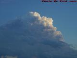
This isn't the particular cloud that dumped on Wellsville some 40 minutes after I took its picture, but it's part of the same cold front that was ripping through the region at the time. (This one was rather south of my vantage point, and probably another 15-20 miles east of where it was when the rain hit the ground.)
This 640x480 Web image has been reduced
for faster browsing.
The finished print contains approximately 70 times as much detail.
Finished prints do not have logos or copyright notices within the image.